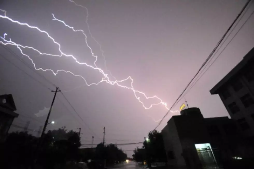
Heavy Rain, Golf Ball Hail, 60 MPH Winds Possible In SE Wyoming Thursday
The Cheyenne Office of the National Weather Service is warning about possible severe thunderstorms Thursday afternoon in southeast Wyoming and the Nebraska Panhandle.
The agency says some of the storms could feature 60 mph downburst winds, heavy rain, and golfball-size hail. The agency posted this statement on its website:
''Greetings! Here's our forecast for southeast Wyoming and Nebraska Panhandle for your Thursday and Thursday evening. Look for storms to begin developing over the mountains shortly after noon time today, that will drift east into the southeast Wyoming plains through the afternoon. Some of these storms could become severe, especially across Laramie County in southeast Wyoming near Cheyenne, as well as Kimball County in the Panhandle. Timing of these severe storms looks to be from 1PM near Cheyenne, Wyoming to 6PM out by Kimball and Scottsbluff. Storms end in the Panhandle around sunset this evening. Be on the lookout this afternoon if you're travelling Interstate 80 from Kimball to Laramie, Interstate 25 from the Colorado line to Chugwater, or near Scottsbluff on Highways 26 and 71. Large hail to possibly golfball size, downburst winds to 60 mph and very heavy rainfall may impact your travel. Be safe!''
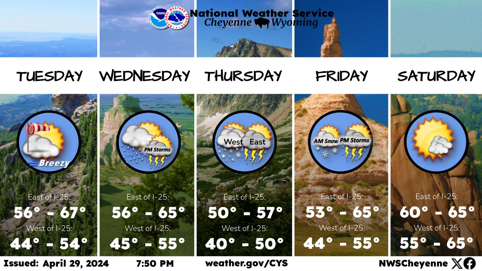
Here is the forecast for Cheyenne:
Today A 50 percent chance of showers and thunderstorms, mainly after noon. Some storms could be severe, with large hail and damaging winds. Areas of fog before 8am. Otherwise, partly sunny, with a high near 81. South southwest wind 5 to 15 mph.
Tonight Scattered showers and thunderstorms, mainly before 8pm. Partly cloudy, with a low around 54. South wind 5 to 10 mph becoming west southwest after midnight. Chance of precipitation is 40%.
Friday A 30 percent chance of showers and thunderstorms after noon. Sunny, with a high near 87. West wind 5 to 10 mph becoming south southeast in the afternoon.
Friday Night Partly cloudy, with a low around 54. South southeast wind 5 to 10 mph becoming southwest after midnight.
Saturday A 30 percent chance of showers and thunderstorms after noon. Sunny, with a high near 87. West southwest wind 5 to 15 mph becoming east in the afternoon.
Saturday NightMostly clear, with a low around 56.
Sunday Sunny, with a high near 87.
Sunday Night Mostly clear, with a low around 56.
Monday Sunny, with a high near 87.
Monday Night Mostly clear, with a low around 55.
Tuesday Sunny, with a high near 85.
Tuesday Night Mostly clear, with a low around 55.
Wednesday Isolated showers and thunderstorms. Sunny, with a high near 86.
LOOK: The most expensive weather and climate disasters in recent decades
LOOK: What are the odds that these 50 totally random events will happen to you?
More From 101.9 KING-FM

![[LOOK] Meet the Dinosaurs That Roamed Across Pre-Historic Wyoming](http://townsquare.media/site/98/files/2024/04/attachment-wyoming-dinosaurs.jpg?w=980&q=75)