Cheyenne Faces Winter Storm Warning Wednesday Night Into Thursday
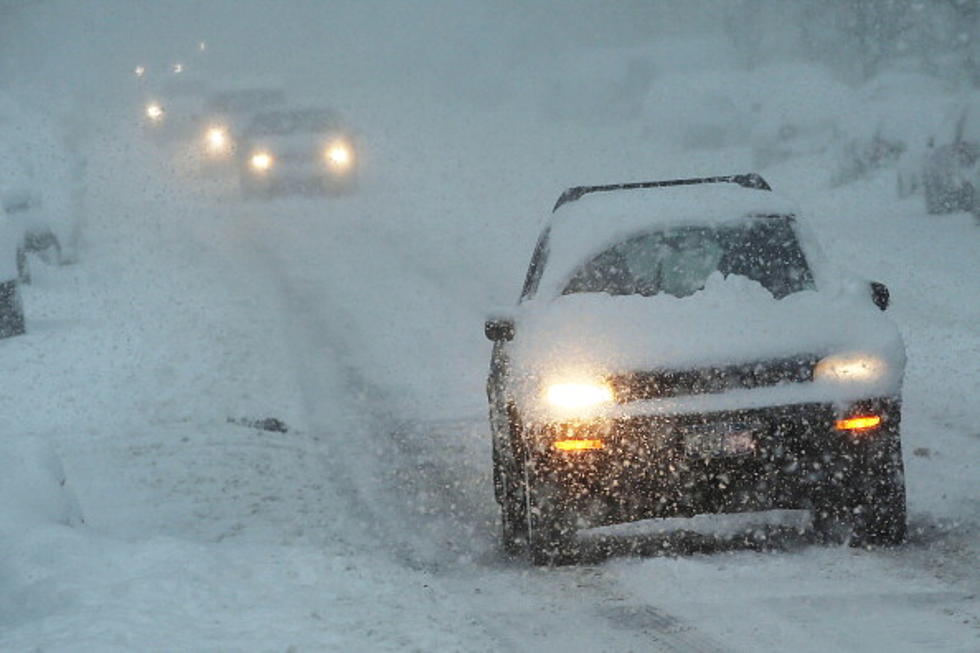
The Cheyenne Office of the National Weather Service has expanded the area of southeast Wyoming covered by a Winter Storm Warning. Five to nine inches of snow is possible as the storm moves through the area Wednesday (April 15) and Thursday.
The expanded area covered by the warning now includes the city of Cheyenne, as well as much of the rest of southeast Wyoming.
The agency posted this statement on its website:
''15/4AM: Winter Storm Warnings (highlighted in pink) in effect for much of southeast Wyoming and the southern Nebraska Panhandle from late this afternoon through Thursday afternoon. Winter Weather Advisories (highlighted in purple) in effect for the northern Nebraska Panhandle, the Laramie Valley and Upper North Platte River Basin. A cold front moving into the area this afternoon, that will bring a brief period of rain before it changes over to snow this evening. Snow looks to be quite heavy this evening through mid morning Thursday, before easing in the afternoon. Strong northeast winds could lead to areas of blowing and drifting snow this evening as well. If planning travel this evening into Thursday across southeast Wyoming and Nebraska Panhandle, be prepared for winter weather conditions. Allow extra time to reach your destination and anticipate travel delays.''
URGENT - WINTER WEATHER MESSAGE
National Weather Service Cheyenne WY
302 AM MDT Wed Apr 15 2020

...A developing winter weather storm will bring accumulating snow
to southeast Wyoming Wednesday afternoon through Thursday
Afternoon...

NEZ019>021-054-055-WYZ104>110-118-119-160000-
/O.UPG.KCYS.WS.A.0011.200416T0000Z-200417T0000Z/
/O.EXB.KCYS.WS.W.0015.200416T0000Z-200417T0000Z/
Scotts Bluff County-Banner County-Morrill-Kimball County-Cheyenne-
Ferris/Seminoe/Shirley Mountains-Shirley Basin-
Central Laramie Range and Southwest Platte County-
East Platte County-Goshen County-Central Carbon County-
North Snowy Range Foothills-Central Laramie County-
East Laramie County-
Including the cities of Scottsbluff, Gering, Harrisburg, Angora,
Bridgeport, Bayard, Redington, Kimball, Brownson, Sidney,
Seminoe Dam, Medicine Bow, Shirley Basin, Bordeaux, Wheatland,
Guernsey, Torrington, Rawlins, Arlington, Elk Mountain, Cheyenne,
and Pine Bluffs
302 AM MDT Wed Apr 15 2020

...WINTER STORM WARNING IN EFFECT FROM 6 PM THIS EVENING TO 6 PM
MDT THURSDAY...

* WHAT...Heavy snow expected. Total snow accumulations of 5 to 9
  inches. Northeast winds up to 30mph will create areas of blowing
  and drifting snow.

* WHERE...Southern Nebraska Panhandle to include Scottsbluff,
  Kimball, Sidney. Southeast Wyoming plains to include Cheyenne,
  Torrington and Wheatland. Lower elevations west of the Laramie
  Range to include Muddy Gap, Rawlins, and Elk Mountain.

* WHEN...From 6 PM this evening to 6 PM MDT Thursday.

* IMPACTS...Travel could be very difficult to impossible this
  evening through Friday morning. Plan on travel delays and snow
  covered roads. Strong winds creating blowing snow and poor
  visibility at times.


PRECAUTIONARY/PREPAREDNESS ACTIONS...

If you must travel, keep an extra flashlight, food, and water in
your vehicle in case of an emergency.

The latest road conditions for the state you are calling from can
be obtained by calling 5 1 1.

Ten Legendary Actors Who Made Movies in Wyoming
More From 101.9 KING-FM