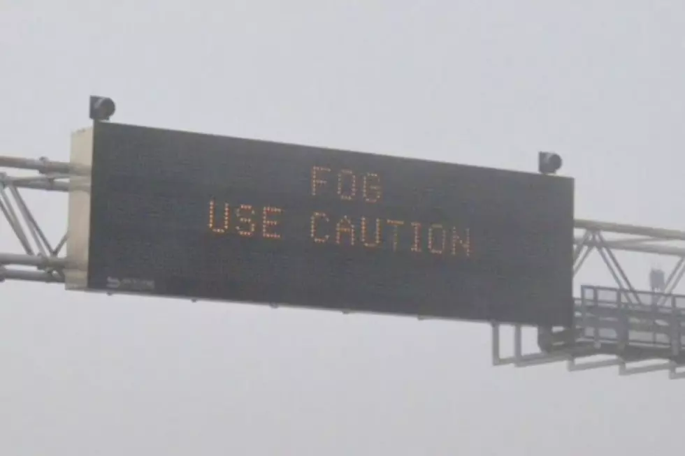
Severe Storms Beginning to Pop Up in Southeast Wyoming
UPDATE:
The Severe Thunderstorm Warning for east-central Goshen County and southwestern Sioux County has expired.
The NWS says the thunderstorm which prompted the warning has weakened below severe limits and has exited the warned area, however, small hail and heavy rain are still
possible with the storm.
Severe Weather Statement
National Weather Service Cheyenne WY
512 PM MDT Fri Jul 8 2022

NEC165-WYC015-082322-
/O.EXP.KCYS.SV.W.0082.000000T0000Z-220708T2315Z/
Sioux NE-Goshen WY-
512 PM MDT Fri Jul 8 2022

...THE SEVERE THUNDERSTORM WARNING FOR SOUTHWESTERN SIOUX AND EAST
CENTRAL GOSHEN COUNTIES WILL EXPIRE AT 515 PM MDT...

The storm which prompted the warning has weakened below severe
limits, and has exited the warned area. Therefore, the warning will
be allowed to expire.  However small hail and heavy rain are still
possible with this thunderstorm.

LAT...LON 4200 10394 4200 10405 4220 10423 4230 10404
      4201 10376
TIME...MOT...LOC 2312Z 251DEG 14KT 4213 10398

$$

Brothers
UPDATE:
The National Weather Service in Cheyenne has issued a Severe Thunderstorm Warning for east-central Goshen County and southwestern Sioux County until 5:15 p.m.
At 4:28 p.m., a severe thunderstorm was located over Torrington, moving east at 15 mph.
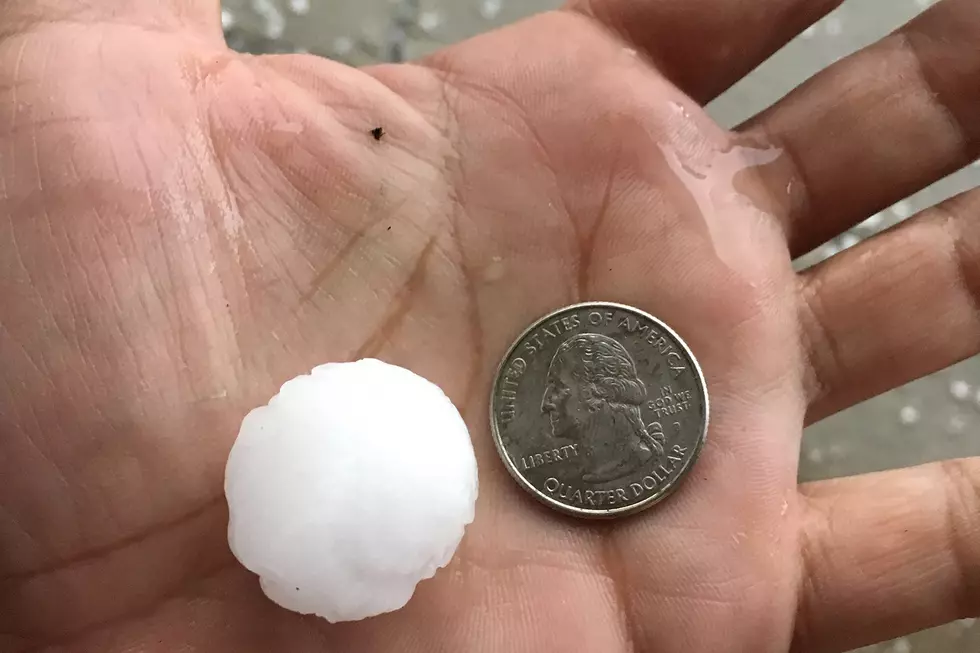
The NWS says this storm will contain golf ball-size hail.
Severe Thunderstorm Warning
NEC165-WYC015-082315-
/O.NEW.KCYS.SV.W.0082.220708T2229Z-220708T2315Z/

BULLETIN - IMMEDIATE BROADCAST REQUESTED
Severe Thunderstorm Warning
National Weather Service Cheyenne WY
429 PM MDT Fri Jul 8 2022

The National Weather Service in Cheyenne has issued a

* Severe Thunderstorm Warning for...
  Southwestern Sioux County in the Panhandle of Nebraska...
  East central Goshen County in southeastern Wyoming...

* Until 515 PM MDT.

* At 428 PM MDT, a severe thunderstorm was located over Torrington,
  moving east at 15 mph.

  HAZARD...Golf ball size hail.

  SOURCE...Emergency management.

  IMPACT...People and animals outdoors will be injured. Expect
           damage to roofs, siding, windows, and vehicles.

* Locations impacted include...
  Torrington and Henry.

PRECAUTIONARY/PREPAREDNESS ACTIONS...

For your protection move to an interior room on the lowest floor of a
building.

&&

LAT...LON 4200 10394 4200 10405 4199 10406 4198 10421
      4215 10433 4230 10404 4201 10376
TIME...MOT...LOC 2228Z 251DEG 14KT 4207 10414

THUNDERSTORM DAMAGE THREAT...CONSIDERABLE
HAIL THREAT...OBSERVED
MAX HAIL SIZE...1.75 IN
WIND THREAT...RADAR INDICATED
MAX WIND GUST...<50 MPH

$$

Brothers
UPDATE:
A Severe Thunderstorm Warning remains in effect until 4:30 p.m. for east-central Goshen County.
Local emergency managers reported quarter-size hail five miles west of Torrington at 4:10 p.m.
Severe Weather Statement
National Weather Service Cheyenne WY
415 PM MDT Fri Jul 8 2022

WYC015-082230-
/O.CON.KCYS.SV.W.0081.000000T0000Z-220708T2230Z/
Goshen WY-
415 PM MDT Fri Jul 8 2022

...A SEVERE THUNDERSTORM WARNING REMAINS IN EFFECT UNTIL 430 PM MDT
FOR EAST CENTRAL GOSHEN COUNTY...

At 414 PM MDT, a severe thunderstorm was located near Torrington,
moving northeast at 15 mph. Local emergency managers reported
quarter size hail 5 miles west of Torrington at 410 PM MDT. This
storm has a history of producing golf ball size hail.

HAZARD...Golf ball size hail and 60 mph wind gusts.

SOURCE...Emergency management.

IMPACT...People and animals outdoors will be injured. Expect hail
         damage to roofs, siding, windows, and vehicles. Expect wind
         damage to roofs, siding, and trees.

Locations impacted include...
Torrington and Lingle.

PRECAUTIONARY/PREPAREDNESS ACTIONS...

Prepare immediately for large hail and deadly cloud to ground
lightning. Seek shelter inside a well-built structure. Stay away from
windows.

&&

LAT...LON 4208 10443 4227 10428 4216 10404 4211 10405
      4197 10429
TIME...MOT...LOC 2214Z 220DEG 15KT 4207 10425

THUNDERSTORM DAMAGE THREAT...CONSIDERABLE
HAIL THREAT...OBSERVED
MAX HAIL SIZE...1.75 IN
WIND THREAT...RADAR INDICATED
MAX WIND GUST...60 MPH

$$

Brothers
ORIGINAL STORY:
Severe storms are beginning to pop up in southeast Wyoming.
The National Weather Service in Cheyenne has issued a Severe Thunderstorm Warning for central Goshen County until 4:30 p.m.
At 3:39 p.m., a severe thunderstorm was located nine miles northwest of Veteran, or 17 miles west of Torrington, moving northeast at 20 mph.

The NWS says hail damage to vehicles and wind damage to roofs, siding, and trees is expected.
Severe Thunderstorm Warning
WYC015-082230-
/O.NEW.KCYS.SV.W.0081.220708T2140Z-220708T2230Z/

BULLETIN - IMMEDIATE BROADCAST REQUESTED
Severe Thunderstorm Warning
National Weather Service Cheyenne WY
340 PM MDT Fri Jul 8 2022

The National Weather Service in Cheyenne has issued a

* Severe Thunderstorm Warning for...
  Central Goshen County in southeastern Wyoming...

* Until 430 PM MDT.

* At 339 PM MDT, a severe thunderstorm was located 9 miles northwest
  of Veteran, or 17 miles west of Torrington, moving northeast at 20
  mph.

  HAZARD...60 mph wind gusts and quarter size hail.

  SOURCE...Radar indicated.

  IMPACT...Hail damage to vehicles is expected. Expect wind damage
           to roofs, siding, and trees.

* Locations impacted include...
  Torrington, Lingle, Fort Laramie, Veteran and Fort Laramie National
  Historic Site.

PRECAUTIONARY/PREPAREDNESS ACTIONS...

For your protection move to an interior room on the lowest floor of a
building.

&&

LAT...LON 4202 10466 4212 10466 4214 10465 4234 10444
      4216 10404 4211 10405 4189 10443
TIME...MOT...LOC 2139Z 220DEG 15KT 4206 10452

HAIL THREAT...RADAR INDICATED
MAX HAIL SIZE...1.00 IN
WIND THREAT...RADAR INDICATED
MAX WIND GUST...60 MPH

$$

Brothers
READ MORE:
LOOK: The most expensive weather and climate disasters in recent decades
Gallery Credit: KATELYN LEBOFF
More From 101.9 KING-FM