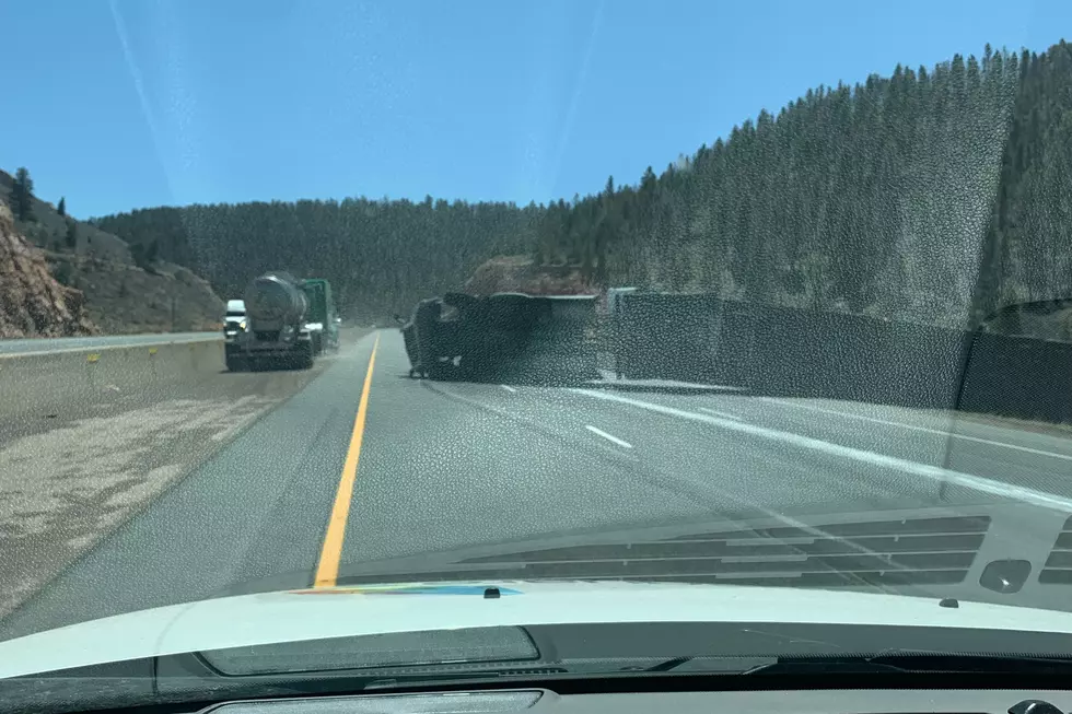
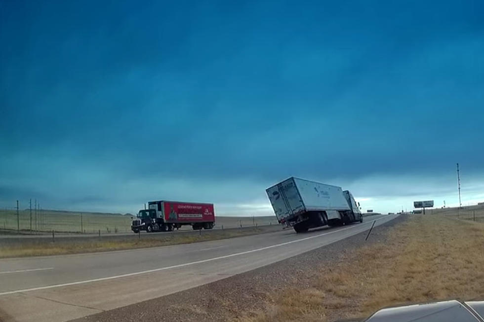
65 MPH Gusts to Blast Parts of Southeast Wyoming Thursday
Wind gusts up to 65 mph are expected to blast parts of southeast Wyoming Thursday, according to the National Weather Service in Cheyenne.
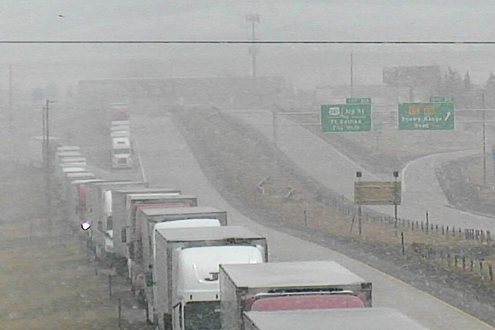
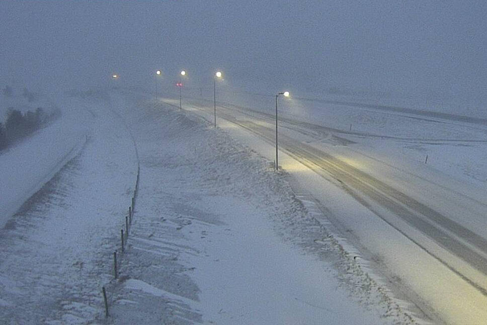
A High Wind Warning is in effect from 5 a.m. Thursday to 5 a.m. Friday for Interstate 80 between Rawlins and Laramie, the I-80 Summit, and Interstate 25 between Chugwater and Wheatland.
URGENT - WEATHER MESSAGE
National Weather Service Cheyenne WY
116 PM MST Wed Feb 9 2022

WYZ106-110-116-101215-
/O.UPG.KCYS.HW.A.0013.220210T1200Z-220211T1200Z/
/O.NEW.KCYS.HW.W.0016.220210T1200Z-220211T1200Z/
Central Laramie Range and Southwest Platte County-
North Snowy Range Foothills-South Laramie Range-
Including the cities of Bordeaux, Arlington, Elk Mountain,
Buford, Pumpkin Vine, and Vedauwoo
116 PM MST Wed Feb 9 2022

...HIGH WIND WARNING IN EFFECT FROM 5 AM THURSDAY TO 5 AM MST
FRIDAY...

* WHAT...West winds 30 to 40 mph with gusts up to 65 mph
  possible.

* WHERE...Central Laramie Range and Southwest Platte County,
  North Snowy Range Foothills, and South Laramie Range. This
  includes Interstate 80 between Laramie and Rawlins, the
  Interstate 80 Summit, and Interstate 25 between Chugwater and
  Wheatland.

* WHEN...5 AM Thursday to 5 AM Friday.

* IMPACTS...Mainly to transportation. Strong cross winds will be
  hazardous to light weight and high profile vehicles, including
  campers and tractor trailers.

PRECAUTIONARY/PREPAREDNESS ACTIONS...

A High Wind Warning means a hazardous high wind event is expected
or occurring. Sustained wind speeds of at least 40 mph or gusts
of 58 mph or more can lead to property damage.

A High Wind Warning is also in effect for I-80 between Laramie and Cheyenne and I-25 in central Laramie County from 11 a.m. Thursday to 5 a.m. Friday.
URGENT - WEATHER MESSAGE
National Weather Service Cheyenne WY
116 PM MST Wed Feb 9 2022

WYZ117-118-101215-
/O.NEW.KCYS.HW.W.0016.220210T1800Z-220211T1200Z/
South Laramie Range Foothills-Central Laramie County-
Including the cities of Whitaker, Federal, Horse Creek,
and Cheyenne
116 PM MST Wed Feb 9 2022

...HIGH WIND WARNING IN EFFECT FROM 11 AM THURSDAY TO 5 AM MST
FRIDAY...

* WHAT...West winds 30 to 40 mph with gusts up to 65 mph
  possible.

* WHERE...South Laramie Range and Adjacent Foothills including
  Interstate 80 between Laramie and Cheyenne. Interstate 25
  corridor in central Laramie County and the city of Cheyenne.

* WHEN...11 AM Thursday to 5 AM Friday.

* IMPACTS...Mainly to transportation. Strong cross winds will be
  hazardous to light weight and high profile vehicles, including
  campers and tractor trailers.

PRECAUTIONARY/PREPAREDNESS ACTIONS...

A High Wind Warning means a hazardous high wind event is expected
or occurring. Sustained wind speeds of at least 40 mph or gusts
of 58 mph or more can lead to property damage.
The NWS issued the following statement Wednesday afternoon:
Greetings. Strong winds are expected to return to the area Thursday. High Wind Warnings are in effect from 5AM Thursday for the wind prone areas. These strong winds are expected to spill out into central Laramie County late morning Monday with a High Wind Warning beginning for the Cheyenne area at 11 AM Thurday. Strong winds are expected to continue through the evening hours Thursday through 5 AM Friday. West winds 30 to 45 MPH with gusts up to 65 MPH are likely in these areas, creating blow off/blow over risks for light weight and high profile vehicles. Be sure to dial 511 or check wyoroad.info for road information prior to traveling. For the latest forecast, refer to weather.gov/CYS
LOOK: The most expensive weather and climate disasters in recent decades
Gallery Credit: KATELYN LEBOFF
More From 101.9 KING-FM